The geodetic world of new technologies
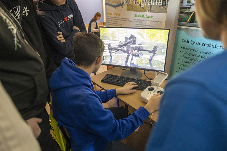
The sight of a drone does not surprise anyone today, but not everyone can fly it - during workshops organized at the Silesian University of Technology as part of the Treasure Week of the European City of Science Katowice 2024, school children could feel like an operator of an unmanned aircraft and look at the world from a different perspective.
Workshop participants could try their hand at controlling a small educational drone that can be safely used inside buildings. Among those willing was Emil Sionkowski, who came to the Silesian University of Technology with a group of pupils from the School Complex in Nakło Śląskie. – It is very pleasant to control such a drone, it is very intuitive, I once tried a completely different model, but I did poorly then – said the pupil.
Those interested could test their skills by controlling a larger device on an unmanned aerial vehicle flight simulator. Olek Otwinowski became a drone operator for the first time. – This requires sensitivity, so far I have hit a wall in the hall – reported the pupil, controlling a virtual drone using a remote control from a Phantom 4 – I am very interested in the topic of drones, if only because I work in the Volunteer Fire Department in Wieszowa and drones help us search for people - added.
The workshop was organized and conducted by dr eng. Aleksandra Mierzejowska from the Department of Geoengineering and Resource Exploitation, Faculty of Mining, Safety Engineering and Industrial Automation, Silesian University of Technology. – We are having some fun here, through which we are moving towards science, because we want to familiarize young people with some of the basic principles of flying, but also to make them realize that this technology has a number of applications in many fields of science – said the scientist. – In geodesy today, it is an indispensable tool, we carry out surveys in order to later create orthophoto maps, digital terrain models or digital land cover models based on the photos. Modern technologies are becoming more and more used, we focus on it when educating students – she added.
The Faculty of Mining, Safety Engineering and Industrial Automation has been running the field of geodesy and cartography for three years, the program of which includes the use of modern technologies as well as programming and computer science.
More information and a schedule of Treasure Week events can be found here.